Fairfax County supervisors on Feb. 20 unanimously approved creation of a new 29.81-acre agricultural-and-forestal (AF) district in Great Falls, which will protect the property from more intensive development in exchange for a tax break.
The applicant, Gary Simanson, bought part of the site in 2005 and in December of that year had the county designate it a local AF district, which subsequently was renewed in 2015. He later bought two contiguous properties, bringing the total site to 29.81 acres, and asked the county to combine them all in a new AF district.
Under the district’s requirements, Simanson will not be allowed to develop the property more intensely for an initial eight-year term, but in return will qualify for reduced land-use taxes. If the property is removed from the AF district before that term expires, the applicant will be subject to a tax penalty and rollback taxes for the past five years.
The site’s addresses are 830, 834, 840, 844 and 900 Leigh Mill Road and 9698 Mill Ridge Road. All seven parcels are zoned R-E (residential estate), which accommodates low-density residential development and agricultural uses.
The applicant uses about 4.8 acres of the site for agricultural purposes, including beekeeping to produce honey, hay production and the keeping of pigs, geese and about 120 chickens. Another 22 acres are either forested or undeveloped.
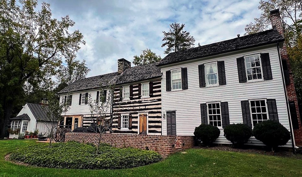
Three residential structures – a circa-1737 farmhouse, a guesthouse built in 2010 and a circa-1927 house for the tenant farmer – are located on 3 acres of the property, along with a barn and outbuilding. The Jackson family cemetery also is located there.
The property is located in the Difficult Run watershed. About 15.04 acres of the site are in an environmental-quality corridor, another 9.18 acres in a resource-protection area and 2.73 acres in a floodplain.
The applicant has recorded a conservation easement with the Northern Virginia Conservation Trust, which will preserve and protect the property and its historic resources in perpetuity.
A soil-and-water-quality conservation plan prepared by the Northern Virginia Soil and Water Conservation District recommended nutrient and pest management and erosion controls at the site. The report, which also suggested record keeping and meadow establishment, complimented the applicant’s bamboo-removal efforts near stream buffers and other areas of the site.
A forester inspected the property and prepared a land-use forest-management plan that calls for reducing the deer herd on the site and removing invasive plant species, county staff said.


